Recommended Posts
Ending the month with a new route
18 comments
Greetings,
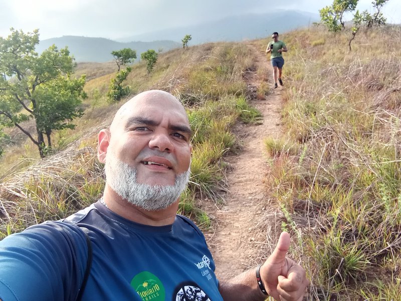
Dear friends today I'm here again, today I made you a video with a new route that I did in the same park where I train most of the time.
This time is a hiking route in the valley of two mountains, is a shorter route of my usual route, in the foreground seems to be an easy route with a large part of the flat route where I could jog a little.
Then to join to the route of the hill the onotal has a slope of 300mts with 20° of inclination that put to test our capacities, when arriving at this summit we are a mountain behind our daily route it is no longer so demanding but we come with the fatigue of the abrupt ascent.
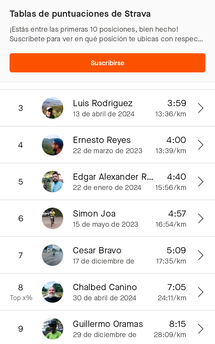
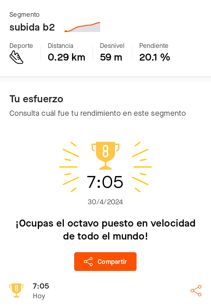
The time on the route was not so bad I managed to establish myself with the eighth best time, now I have to repeat this route to lower some positions but it is not so easy because the time that is below mine is more than two minutes ahead.
Screenshot_20240430-092014.png](https://files.peakd.com/file/peakd-hive/soychalbed/23uFwHtgNycqyXjbUCXLhNE1wtSmNDk6oSzXfpV333y3m59wZboZ1AtZRs239Vp4whSQz.png)
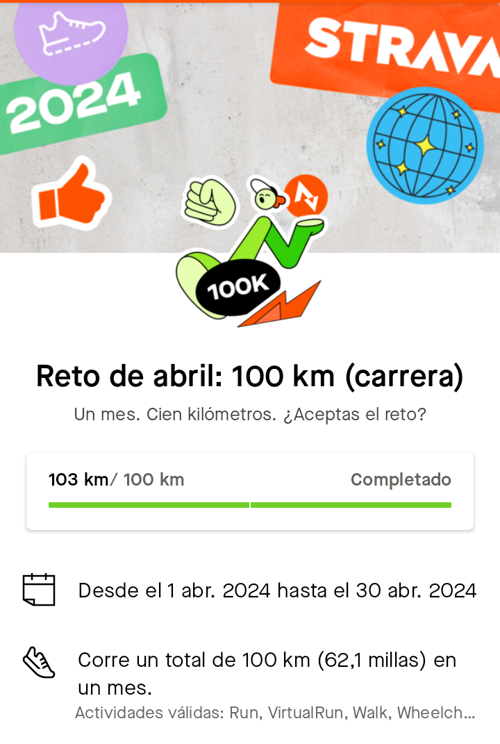
With this route today I managed to earn my Strava 100km route badge for the month of April finishing the month with a cumulative 103km.
It was a pretty productive month I hope this May to improve even more, here you can see my route today on Strava.
I hope you enjoy the video, we keep adding miles.
The photos and video are my property taken with the Infinix Hot 10 i cell phone, the video was edited with the capcut app.
Translated with DeepL.com (free version)
SPANISH
Saludos,
Queridos amigos hoy estoy nuevamente por aquí, el día de hoy les hice un video con una nueva ruta que realice en el mismo parque donde entreno la mayor parte del tiempo.
Está vez es una ruta de senderismo en el valle de dos montañas, es una ruta más corta de mi ruta habitual, en primer plano parece ser una ruta facil con una gran parte del trayecto plana donde pude trotar un poco.
Luego para empalmar a la ruta del cerro el onotal tiene una pendiente de 300mts con 20° de inclinación que ponen a prueba nuestras capacidades, al llegar a esta cima quedamos una montaña atrás de nuestra ruta diaria ya no es tan exigente pero venimos con la fatiga del ascenso brusco.
El tiempo en la ruta no estuvo tan mal logré establecerme con el octavo mejor tiempo, ahora toca repetir está ruta hasta bajar algunas posiciones pero no está tan fácil porque el tiempo que está por debajo del mío lleva más de dos minutos de ventaja.
Con esta ruta del día de hoy logré ganarme la insignia de Strava de 100km de ruta en el mes de abril terminando el mes con un acumulado de 103km.
Fue un mes bastante productivo espero este mes de mayo mejorar aún más, aquí pueden ver mi ruta de hoy en Strava.
Espero que disfruten del video, seguimos sumando kilómetros.
Las fotos y el vídeo son de mi propiedad tomadas con el celular Infinix Hot 10 i, el vídeo fue editado con la app capcut.
▶️ 3Speak
Comments